Avalanche Incident Report
February 23, 2023
South side of Denny Mt, Snoqualmie Pass, WA
By Trevor Kostanich
February 23, 2023
South side of Denny Mt, Snoqualmie Pass, WA
By Trevor Kostanich
Incident Summary: On February 23, 2023, I unintentionally triggered a small wind slab on a personal trip with a strong touring partner. We travelled up the Alpental Valley over Pineapple Pass into the Denny Creek drainage interested to look at a new ski line to us coming south off Pt 5519 (north of Denny Mt true summit). There was expected instability with new low density storm snow and moderate to strong winds. We went into the day not expecting to ski the small couloir feature from the top based on expected wind slab but wanted to assess with a closer look expecting good, and more stable snow, mid slope down into Denny Creek. We observed lots of wind, and wind affected snow, in the Alpental parking lot and throughout open slopes while we travelled up the Alpental Valley. Pineapple Pass was calm and supported our thinking that our desired south aspects in Denny Creek would be protected from the easterly winds. This thinking was reassured during a fantastic ski in Denny Trees (southeast of Pineapple Pass). We expected more wind affect when we entered the more open terrain below Pt 5519. To our surprise there was minimal signs of wind slab on the apron below the couloir feature. With no cohesion in the new snow, we continued higher with me leading. As the slope angle increased (~37-40 degrees), cohesion in the top of the snow surface was observed. Initially just some cohesion in the top inch but quickly I was getting 3’ cracks in the top few inches of snow. At this time, I knew we were close to our high point yet continued across the bottom of the couloir expecting to transition climber’s left of the couloir. In just a couple strides, the slope failed with the crown about 30 feet above me. I quickly realized I was not able to arrest and moving downhill in the avalanche. I was able to turn my skis to face downhill but couldn’t stand up as rode down the slide in a controlled squatting position. I could see my partner was not in the path and had eyes on me. I felt in control to steer my skis a certain direction down the hill but was not able to stand up and ski out. I travelled about 200 vertical feet down the slope and was finally able to ski out to the right side as the debris was slowing to a stop. I was uninjured.
Occurrence Time and Date: 08:50am on February 23, 2023
Location: South of Pt 5519 on Denny Mt, Snoqualmie Pass, WA
Lat/Long: 47.44157, -121.44961
Number in Party: 2
Number Involved: 1
Number Buried (Partial or Full): 0
Number Injured: 0
Avalanche Type: SS
Trigger: ASu
Size: R2/D1
Start Zone Aspect: SSW
Start Zone Angle: Estimate 42 degrees
Start Zone Elevation: 5290’
Crown Height: 0.5’ average, 1.5’ max
Fracture Width: ~40’
Fracture Length: ~60’
Bed Surface Characteristics: S, new snow
Avalanche occurred during: Ascent
Location of partner in relation to start zone: Below and to the side (just barely west of slide)
Avalanche Safety Gear Carried: Both skiers were travelling with transceivers, probes, and shovels with transceiver check conducted at the trailhead.
Avalanche Training & Experience of Activity: Skier caught is a professional (AMGA Ski Guide and AIARE Course Leader). Other party member is expert skier with avalanche training and many years of touring experience. The two have accomplished objectives together, including a couple desired lines around Snoqualmie Pass this season.
NWAC Forecast Zone: Snoqualmie Pass
Avalanche Danger Rating: Considerable ATL, Moderate NTL & BTL. Wind Slab was the only forecasted problem at all elevations, all aspects, likely up to D2. Archived forecast here.
Terrain: The avalanche occurred in the bottom of a couloir feature on a SSW aspect in alpine terrain. The slope angle increased as you ascended in the couloir. There was lower angle terrain below the couloir, yet still over 30 degrees, before hitting treeline. This was new terrain to both party members with some analysis of photos of the terrain conducted prior to the trip.
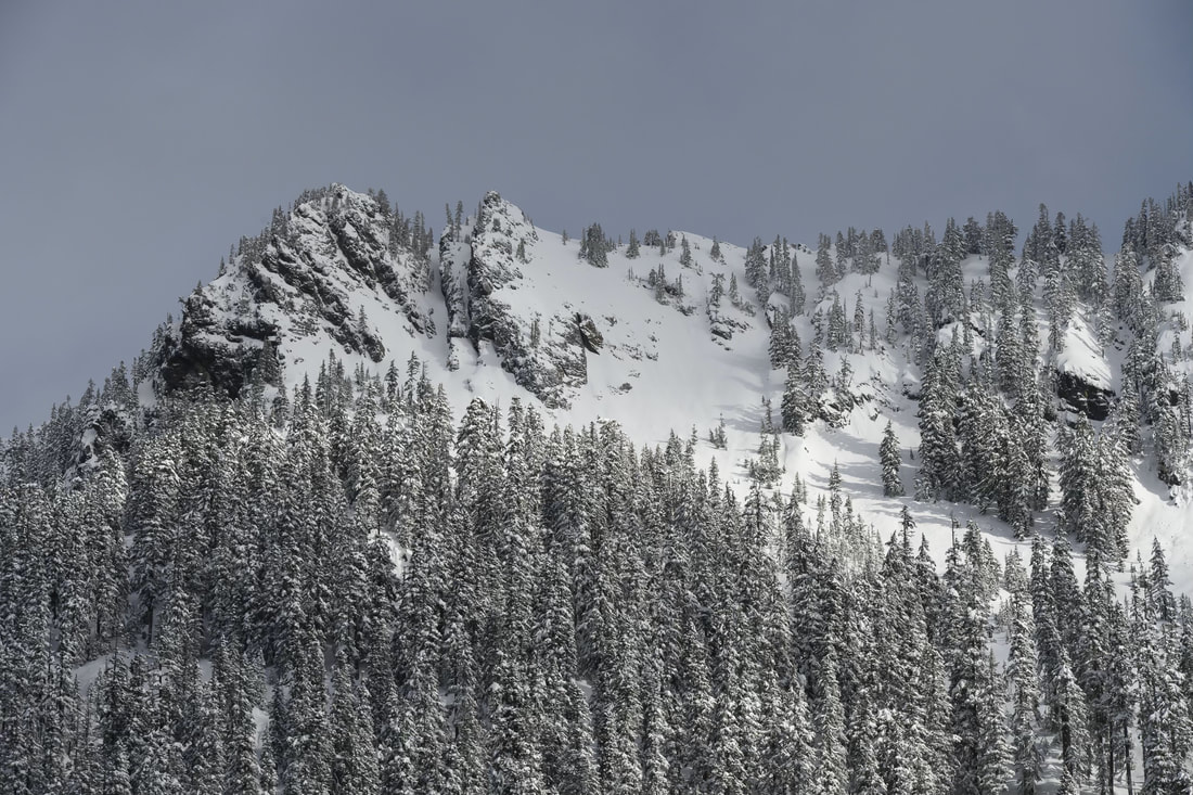
Figure 1: Scott Rinckenberger photo of line from Low Pt
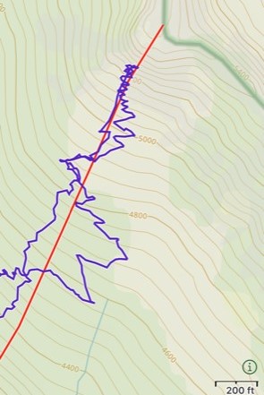
Figure 2: Gaia track (purple) on terrain map
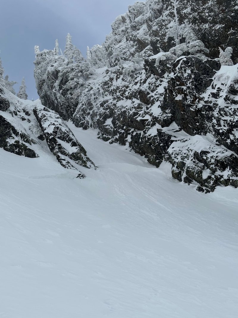
Avalanche: The avalanche occurred on a SSW aspect at approximately 5290’ in the bottom of a couloir feature. It had an estimated average crown depth of 8” and maximum depth of 18” based on wind deposit. The avalanche was estimated to be 40’ wide and 60’ long and initiated at a slope angle estimated to be 42 degrees. I unintentionally triggered the avalanche while skinning up into the bottom of the couloir with me being in the middle/lower portion of the slab as it released.
Figure 3: Scott Rinckenberger photo of crown
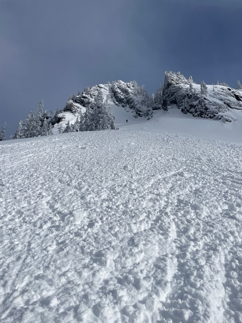
Figure 4: Looking up from bottom of path
Figure 5: Looking back at slide from below path
Snowpack: Considered right side up with about 2’ of low density storm snow from 2-3 days earlier over more dense settled storm snow. Winds changed 24 hours earlier from westerly to easterly with moderate winds forecasted from the E/SE. The low density snow was easy for wind transport and small wind slabs were expected in many parts of the terrain.
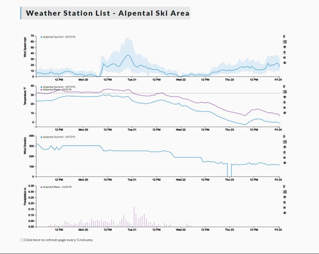
Weather: Cold temps with parking lot near 0 degrees F as we started moving shortly after 6am. E/SE moderate winds were more noticeable in the valley with calm/light winds at Pineapple Pass. Scattered clouds clearing throughout the day. Archived NWAC weather forecast here.
Weather: Cold temps with parking lot near 0 degrees F as we started moving shortly after 6am. E/SE moderate winds were more noticeable in the valley with calm/light winds at Pineapple Pass. Scattered clouds clearing throughout the day. Archived NWAC weather forecast here.
Debrief Notes:
- On a personal trip with a strong partner, I consciously accepted more risk to push closer to the margin.
- I pushed beyond the margin (unintentionally) and fortunately did not get hurt. I should have respected my intuition and stopped at last kick turn when I internally knew we wouldn’t ski the line. No point in going any higher at that point.
- A more prudent plan (and expected if I was operating professionally), would have closed this terrain feature for the day and we would have never investigated so closely. This is the benefit of what we teach to remove these options before in the field.
- A week earlier myself and this same partner skied an aggressive line off Rampart Ridge. That day was much different as conditions were rarely ideal for the line we skied and I had much more confidence throughout the day. But of note, and I think very relevant, is my partner that Rampart Ridge day shared some concern as we travelled up through a small alpine basin with increased winds that were minimally transporting surface snow. While this was a sign of instability in this localized terrain feature, I believed conditions would be different on our line based on aspect/terrain and the overall favorable conditions supported us taking a closer look at our desired line. The partner agreed to continue on to our primary objective and it turned out our line was great with no signs of instability. I think getting a positive reassurance of this the week prior allowed me to keep the Feb 23 couloir feature as an option (both in our day’s trip planning and in the field looking for signs of instability). Surprised I had not seen instability sooner, I may have been pushing until it was more obvious to both of us that the line wouldn’t be safe to ski that day. While I still believe investigating further to learn more is a prudent skill, it is important to realize this mentality can get us in trouble and should remain an option only with no to very low consequences.
- I did not yell when first in the avalanche to make sure my partner knew what was happening. While I quickly saw that they saw me, this was still a mistake especially with how much I teach this in avalanche courses.
- I was acutely analyzing consequences if the slope slid. This was good as resulted in a controlled ride while caught and uninjured. However, I may have gotten lucky here as wind deposit depths can often surprise us especially in such a constrained terrain feature. I also could have gotten knocked over with a minor sprain/strain injury from this slide.
- If injured, I was in very cold conditions and a bad location for a rescue which would have resulted in higher consequences.
- Made mistakes and hope to learn from them and share so others can learn from them.
